
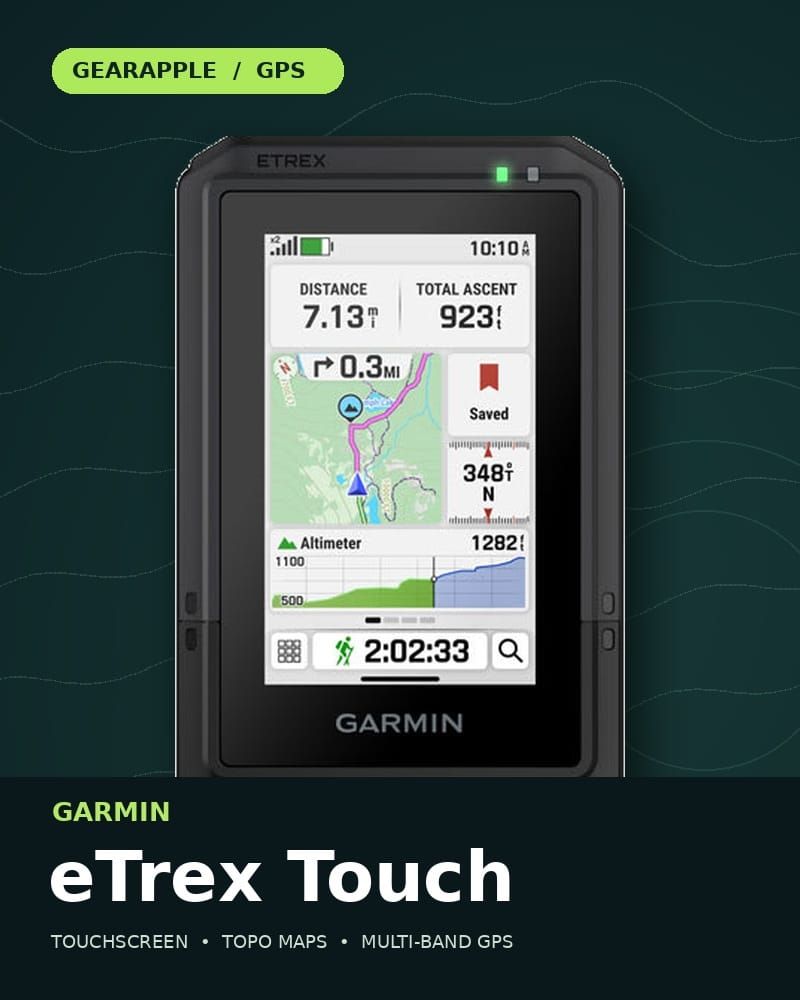
The quick take: The Garmin eTrex Touch is a touch GPS handheld navigator with a 3-inch color touchscreen, preloaded trail maps, multi-band satellite reception, and exceptionally long claimed battery life in a compact form factor. It makes the most sense for hikers, hunters, geocachers, and bikepackers who want a dedicated navigation device. It does not provide inReach satellite messaging or an SOS button.
Check the Garmin eTrex Touch on Amazon | See Garmin's product page
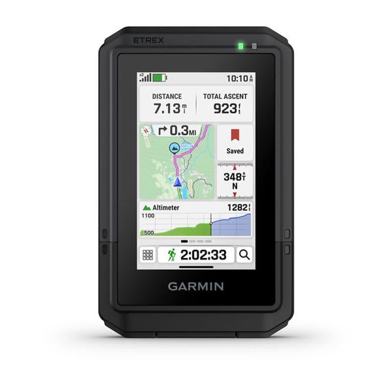
A phone can show you a trail map, so why carry a separate GPS? Battery planning, ruggedness, and keeping navigation on its own device are the strongest reasons. Garmin's current eTrex Touch is built around those jobs, purpose-built for outdoor use and designed to withstand weather and rugged conditions, with a touchscreen that makes the map easier to use than the button-driven eTrex SE.
Garmin eTrex Touch Specs
Feature | Garmin eTrex Touch |
|---|---|
Display | 3-inch color touchscreen; 240 × 400-pixel display resolution |
Maps | Preloaded TopoActive maps with routable roads and trails |
Satellite reception | Multi-GNSS and multi-band support with SatIQ |
Claimed battery life | Up to 130 hours in all-satellite, multi-band use with SatIQ; up to 650 hours in expedition mode |
Battery | Built-in rechargeable lithium-ion |
Water and dust rating | IP67 |
Operating temperature | −20°C to 60°C |
Connectivity | Garmin Explore app; Wi-Fi and Bluetooth |
Navigation tools | Barometric altimeter, customizable data fields, geocaching, and proximity alarms |
Charging and mounting | USB-C port under a weather cap; Spine Mount 2 connection for compatible accessories |
Weight / storage | 5.3 ounces / 32 GB, according to GearJunkie |
Launch MSRP | $449.99; check current pricing before publication |
Garmin's battery figures are maximum estimates under specified settings and conditions, and real-world battery life may be less than advertised. Plan conservatively if you run a bright display or use the device frequently. Garmin's announcement describes the 130-hour claim as all satellite systems plus multi-band with SatIQ.
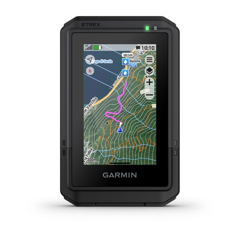
Garmin eTrex Touch Maps, Preloaded Maps, and Navigation
The biggest upgrade is the map interface. You can easily swipe the map and zoom on the 3-inch high-resolution color touchscreen to inspect a junction, look ahead along a route, or choose a destination, and the display is readable in sunlight outdoors. GearJunkie's Nick Belcaster found it quick and usable during his field testing, including in wet or dirty conditions, though he sometimes needed to wipe the screen. That observation belongs to his test; GearApple has not independently tested the unit.
The Garmin eTrex Touch comes with preloaded TopoActive maps for roads and trails, without requiring a premium map subscription. You can plan trips in the Garmin Explore app and sync routes and waypoints from a phone. On the handheld, turn routing can follow map data toward a selected destination and recalculate when needed; an on-screen pointer shows the next waypoint or turn, and it can provide route suggestions toward the best routes through routable map data, but it does not lean on popularity routing or round trip routing the way Garmin's bike computers do. This is a different workflow from Google Maps: download the map content you need before a trip and navigate with the eTrex even when your phone has no cell signal. Garmin Connect appears in some Garmin product listings, but Garmin instructs owners to pair this model with Garmin Explore. If you want additional maps or premium mapping content such as satellite imagery, Garmin sells Outdoor Maps+ separately for ongoing access rather than including it with the base device. The topo mapping includes terrain contours, topographic elevations, geographical points, points of interest, and city navigator-style road routing only where the map product supports it. The base navigation features are the reason to buy the device; decide whether those extra layers matter for your routes before paying for them.
The eTrex Touch uses multi-band GPS support when a route passes through tree cover or terrain that interferes with satellite signals. The receiver can use more satellites and frequency bands for more reliable positioning in difficult terrain; Garmin also offers satellite prediction data to help it get an initial fix quickly. Under favorable conditions, dual-band accuracy can reach 6 feet, but it will still vary with cover and terrain. These features support accurate tracking but do not guarantee a precise GPS location in every canyon or forest. In GearJunkie's controlled track test, the eTrex Touch closely followed the selected lane over 10 laps without a reported signal loss. That is a promising result, though it is one reviewer's test rather than a guarantee of accuracy across the board.
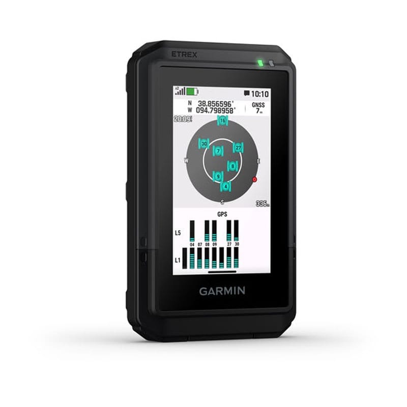
Garmin eTrex Touch Geocaching and Trail Tools
The barometric altimeter plots elevation changes and can be calibrated automatically or manually. You can adjust the home screen and map data fields to keep key information, such as the trip odometer and elevation, in view, so you don't have to dig through menus. It also includes activity profiles for hiking, cycling, and geocaching. A trip odometer data field tallies the distance since the last reset, along with other trip statistics. For outdoor enthusiasts, those small controls can be a big deal on a longer route.
Geocaching is more than just entering coordinates. The eTrex Touch can display downloaded caches, support paperless geocaching, and, when paired through Garmin Explore, work with Geocaching Live for synced cache details as part of that workflow, while optional proximity alarms sound when you approach a chosen waypoint or cache. That helps when you are looking for a trail junction, camp, or a cache without constantly staring at the screen, and it can save a GPS location precisely enough for returning to a specific tree or camp, with accuracy often cited around 2 to 3 feet in ideal conditions rather than guaranteed in every environment. Garmin's manual explains waypoint proximity alarms and geocaching settings.
Connected weather information is useful for trip planning, but it requires a paired phone or network connection; it is not an offline weather forecast. The unit's USB port is covered by a protective weather cap for charging or connecting to a computer. On the back, Garmin's Spine Mount 2 is an integrated spine mount for compatible clips, tethers, and other accessories. If you want a lanyard, holster, case, cover, or spare charging cable, check compatibility with the current eTrex Touch and Spine Mount 2 before buying; accessories for the older Touch 25 and 35 may differ. See the device overview. After an outing, you can sync to Garmin Explore to review trip data and later review trips.
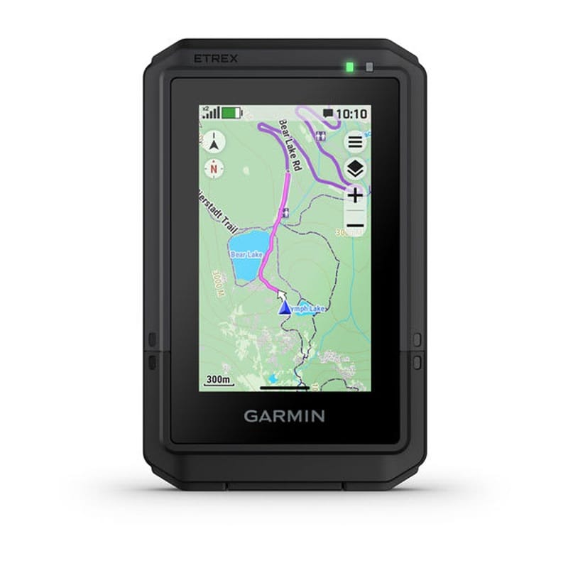
Garmin eTrex Touch Battery Life and Limits
Garmin rates the eTrex Touch for up to 130 hours, assuming typical use with SatIQ technology in all-satellite multi-band mode, or up to 650 hours in expedition mode; that estimate reflects typical use with SatIQ, assuming typical conditions, plus multi-band mode, and the device’s long battery life claims rather than a worst-case draw. Those are different operating modes, and assuming typical use, real-world results are often lower than headline figures—especially with frequent map interaction or a bright display. On a multi-day trip, the USB charging port and a power bank deserve a place in your kit.
What could be better
The 3-inch screen is easier to navigate than the SE's button interface, but it is still small next to a modern phone. At 240 × 400 pixels, the display resolution is modest beside a phone, and GearJunkie found the menu structure less polished than it could be. The internal rechargeable battery means you need a charging plan on extended trips; you cannot swap in fresh AA batteries like you can with the eTrex SE.
Most importantly, this is a navigation device, not a satellite communicator. It does not add inReach messaging or an emergency SOS service. If contacting someone beyond cell coverage is part of your safety plan, carry a suitable communicator separately.
eTrex Touch vs. eTrex SE
Choose the eTrex Touch if… | Choose the eTrex SE if… |
|---|---|
You want a color touchscreen and preloaded routable maps. | You prefer simple physical controls and a lower-cost GPS. |
You want multi-band satellite reception. | You value replaceable AA batteries. |
You regularly inspect maps and build routes on the handheld. | You mainly need position, waypoints, and basic navigation. |
Garmin eTrex Touch vs. eTrex 10, 32x, and Solar
The eTrex name covers several generations, from monochrome GPS receivers to color mapping units and this touchscreen navigator. That history matters when comparing maps and battery life: a feature listed for one eTrex model may not apply to another.
Model | Maps and battery | What changes compared with the eTrex Touch |
|---|---|---|
Basic worldwide basemap; up to 25 hours on AA batteries | No detailed map expansion or color touchscreen; GPS and GLONASS for basic navigation and geocaching | |
Preloaded TopoActive maps; 8 GB internal memory, microSD map expansion, and up to 25 hours on AA batteries | Physical controls plus a 3-axis compass and barometric altimeter | |
Up to 200 hours in GPS-only mode; Garmin's unlimited solar claim requires 75,000-lux conditions | Solar endurance instead of the Touch's large color map display | |
eTrex Touch | Routable TopoActive maps; up to 130 hours in all-satellite, multi-band use or 650 hours in expedition mode | 3-inch touchscreen, multi-band satellite reception, and rechargeable battery |
The eTrex 32x lets you load compatible custom maps with a microSD card; older eTrex models can also use additional maps via microSD, while the current Touch relies on its internal storage and Garmin's supported map ecosystem. The eTrex 10 cannot add detailed maps. Garmin recommends lithium or NiMH AA batteries for some older eTrex devices, but runtime varies with settings and conditions. Each model also has its own water rating: the eTrex Touch is IP67, built for rugged conditions, and has an impact-resistant design tested to MIL-STD-810 specifications to withstand weather. The Touch uses more satellite constellations and multi-band signals than the GPS/GLONASS-focused older models, although no handheld can promise identical positioning under every tree canopy or in every canyon. Garmin's eTrex Touch announcement.
Is the Garmin eTrex Touch Worth It?
The Garmin eTrex Touch is a strong fit for anyone who wants a self-contained trail navigator with easy map interaction and long claimed runtime. Its appeal is clearest when you spend enough time away from cell coverage to appreciate dedicated navigation. If your only need is a quick map check on familiar day hikes, the price may be hard to justify. And if emergency messaging is essential, budget for a separate satellite communicator.
See Garmin eTrex Touch listings on Amazon
Frequently asked questions
Does the eTrex Touch need a subscription? No subscription is required for its preloaded TopoActive maps and ordinary GPS navigation. Outdoor Maps+ premium layers are optional premium mapping content and may require ongoing access through a separate subscription.
Does it work without cell service? The handheld's satellite positioning and preloaded maps work without cell service. Plan and load any routes or map content you need before leaving connectivity, including any extra map layers or additional maps you want available offline.
Can it send an SOS message? No. The eTrex Touch does not have built-in inReach messaging or SOS.
Is this the older eTrex Touch 25 or 35? No. This article covers the current 3-inch, rechargeable eTrex Touch introduced in 2025. Older Touch 25 and 35 models have different specifications. The basic worldwide basemap discussed above is included with the eTrex 10; the current Touch comes with TopoActive maps.